Last updated 2024-04-16
Macau Peninsula
The Macau Peninsula is the most populous and historical part of Macau. It has an area of 8.5 square kilometers (3.3 sq mi) (4 by 1.8 kilometers (2.5 mi × 1.1 mi)) and is geographically connected to Guangdong Province at the northeast through an isthmus 200 meters (660 ft) wide. The peninsula, together with downtown Zhuhai, sits on an island separated from the continent by distributaries of the Pearl River. The Border Gate (Chinese: 關閘; Portuguese: Portas do Cerco) was built on the northern isthmus. At the south, the peninsula is connected to Taipa Island by three bridges, the Friendship Bridge (Ponte de Amizade); the Macau-Taipa Bridge (Ponte Governador Nobre de Carvalho); and the Sai Van Bridge (Ponte de Sai Van). The longest axis extends 4 kilometers (2.5 mi) from the Border Gate to the southwestern edge, Barra (媽閣嘴). There is a western "Inner Harbor" (內港) paralleled by an "Outer Harbor" (外港) to the east. The 93 meters (305 ft) Guia Hill (松山) is the highest point on the peninsula, which has an average elevation of 50 to 75 meters (164 to 246 ft). Many coastal places are reclaimed from the sea. The Historic Centre of Macau, which is entirely on the Macau Peninsula, became a World Heritage Site in 2005.
Districts
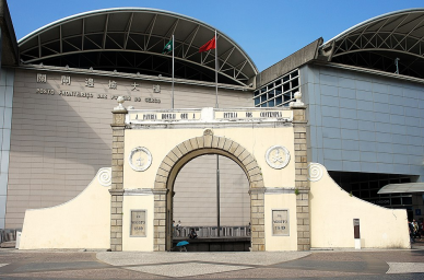
Checkpoint
List all Checkpoint from Macau Peninsula
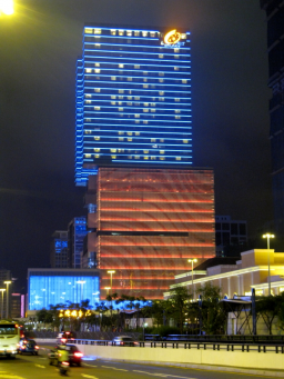
Hotel & Casino
List all Hotel & Casino from Macau Peninsula
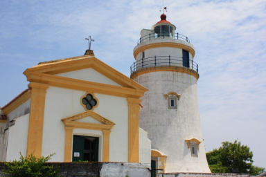
Landmark
List all Landmark from Macau Peninsula

Estate
List all Estate from Macau Peninsula
Your Pathfinding Guru in Macau
Finding the list above is too lengthy? Simply use Pokeguide app to search how to go from places to places by public transportation. We also have AI ETA that filters relevant ETAs for you smartly!